
Most Popular Products


Topographical Survey Service Provider


Topographical Survey Service Provider Specification
- Application
- Civil Engineering, Construction, Land Development
- Data Deliverables
- Topographical Maps, Contour Maps, Digital Elevation Models (DEM), Survey Reports
- Service Duration
- As per Project Requirement
- Accuracy Level
- High Precision (Up to ±5mm depending on instrument)
- Product Name
- Topographical Survey Service Provider
- Service Location
- Pan India
- Service Availability
- 24/7 Support Available
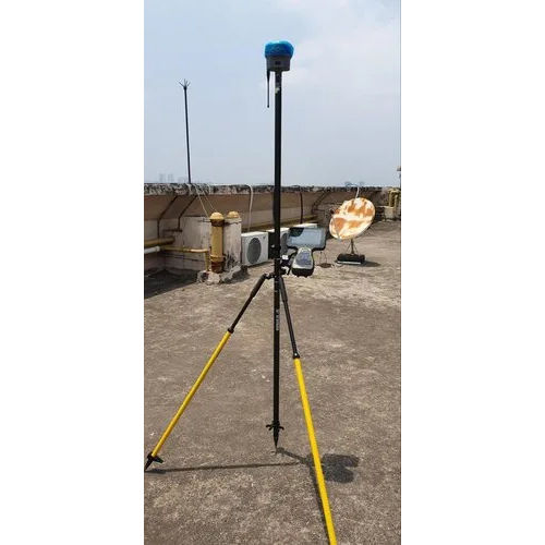
- Survey Instruments Used
- Total Station, GPS, Theodolite, Drone Surveying Equipment
- Industries Served
- Real Estate, Infrastructure, Mining, Agriculture, Government Projects
- Survey Type
- Topographical Survey
- Client Consultation
- Site Visit, Requirement Assessment, Customized Solutions
- Team Expertise
- Qualified Survey Engineers and Technicians
- Service Mode
- Offline
About Topographical Survey Service Provider
A topographical survey service provider specializes in mapping and documenting the physical features and terrain of a specific area of land. Their services typically include the use of advanced surveying equipment and technologies, such as GPS and total stations, to capture precise data on the land's contours, elevations, and natural or man-made features. This information is then used to create detailed maps, 3D models, and plans that are essential for construction, civil engineering, land development, and environmental planning projects. The provider ensures accuracy and compliance with relevant regulations, helping clients make informed decisions about land use and development.Comprehensive Survey Solutions Pan India
From urban construction sites to agricultural farmlands, our topographical surveys span the entirety of India. We are equipped to handle projects of any scale, serving multiple industries with precision. Our expert team ensures each survey is adapted to the unique requirements of every location, providing clients with the data they need for effective land development and civil engineering projects.
State-of-the-Art Survey Instruments
We utilize cutting-edge survey technology such as Total Stations, high-precision GPS receivers, Theodolites, and advanced drones for aerial data capture. This combination allows us to achieve exceptional accuracy up to 5mm. Our instrument selection is project-specific, ensuring the optimal balance of efficiency, safety, and precision in every survey.
Deliverables That Drive Decision-Making
Our deliverables include topographical maps, contour maps, digital elevation models (DEM), and comprehensive survey reports. Each output is prepared with meticulous attention to detail, providing actionable insights for project planning and execution. The data we provide empowers stakeholders to make informed decisions throughout every phase of their projects.
FAQ's of Topographical Survey Service Provider:
Q: How is a topographical survey conducted for my project?
A: Our qualified engineers begin with a site visit and requirement assessment. After selecting the appropriate instruments (such as Total Station, GPS, Theodolite, or drone), we collect detailed field measurements. The gathered data is then processed to create accurate topographical and contour maps, DEMs, and survey reports tailored to your project's needs.Q: What benefits does drone surveying offer in your topographical services?
A: Drone surveying enables rapid and comprehensive aerial data collection over large and inaccessible areas. It improves efficiency, reduces human error, and captures high-resolution imagery, resulting in highly accurate maps and models for better project planning and resource management.Q: Which industries can benefit from your topographical survey services?
A: We serve a diverse range of industries including real estate, infrastructure, mining, agriculture, land development, construction, and government sectors. Our surveys support applications in civil engineering and ensure precise data for planning, compliance, and design.Q: When are your surveying services available and how long does a survey take?
A: Our topographical survey services are available 24/7 across India. The duration of each survey depends on the project's scale and requirements, with timelines determined during the initial consultation and site assessment to best meet your deadlines.Q: Where do you provide topographical survey services?
A: We operate pan India, delivering on-site topographical surveys wherever your project is located. Our experienced team is equipped to travel and conduct surveys in varied terrains, from urban developments to rural and remote locations.Q: What types of data deliverables can I expect from your service?
A: Clients receive detailed topographical maps, contour maps, digital elevation models (DEM), and comprehensive survey reports. These deliverables are formatted according to your requirements, supporting design, construction, and compliance documentation.Q: How does your team ensure high precision in the survey results?
A: Our team combines technical expertise with the use of advanced instruments-some achieving precision up to 5mm. Strict quality controls and data processing standards are maintained throughout each phase, ensuring reliable and accurate survey outputs.Tell us about your requirement

Price:
Quantity
Select Unit
- 50
- 100
- 200
- 250
- 500
- 1000+
Additional detail
Mobile number
Email

More Products in Global Positioning System Category
Differential Global Positioning System
Price 2000000 INR / Unit
Minimum Order Quantity : 1 Unit
Weight : 1.4 Kilograms (kg)
Material : MS
Operate Method : SemiAuto
Product Type : Differential Global Positioning System

Quick Inquiry


Contact Details
AISTECH GLOBAL PRIVATE LIMITED
GST : 19AATCA7893D1ZZ
GST : 19AATCA7893D1ZZ
313/7, Nabapally, Sector- 4, Salt Lake, Kolkata - 700105, West Bengal, India
Phone :07971549274

 |
AISTECH GLOBAL PRIVATE LIMITED
All Rights Reserved.(Terms of Use) Developed and Managed by Infocom Network Private Limited. |
