
सबसे लोकप्रिय उत्पाद


Specification
- Data Deliverables
- Topographical Maps, Contour Maps, Digital Elevation Models (DEM), Survey Reports
- Service Location
- Pan India
- Service Mode
- Offline
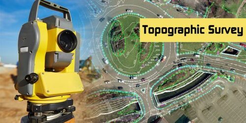
- Product Name
- Topographical Survey Service Provider
- Service Availability
- 24/7 Support Available
- Survey Instruments Used
- Total Station, GPS, Theodolite, Drone Surveying Equipment
- Team Expertise
- Qualified Survey Engineers and Technicians
- Application
- Civil Engineering, Construction, Land Development
- Client Consultation
- Site Visit, Requirement Assessment, Customized Solutions
- Industries Served
- Real Estate, Infrastructure, Mining, Agriculture, Government Projects
- Service Duration
- As per Project Requirement
- Survey Type
- Topographical Survey
- Accuracy Level
- High Precision (Up to ±5mm depending on instrument)
Tell us about your requirement

Price: Â
Quantity
Select Unit
- 50
- 100
- 200
- 250
- 500
- 1000+
Additional detail
मोबाइल number
Email

अधिक Products in Global Positioning System Category
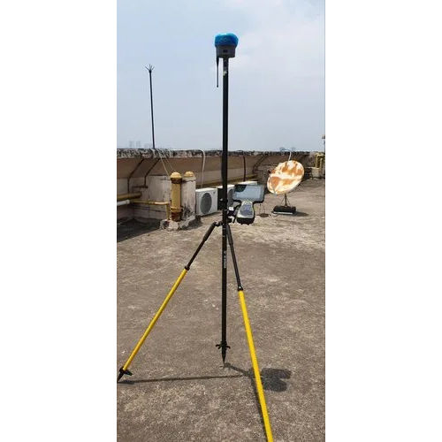
डिफरेंशियल ग्लोबल पोजिशनिंग सिस्टम
मूल्य या मूल्य सीमा : आईएनआर
मूल्य की इकाई : यूनिट/यूनिट
माप की इकाई : यूनिट/यूनिट
न्यूनतम आदेश मात्रा : 1
प्रॉडक्ट टाइप : Differential Global Positioning System
वज़न : किलोग्राम (kg)

त्वरित पूछताछ


सम्पर्क करने का विवरण
GST : 19AATCA7893D1ZZ
फ़ोन :07971549274

 |
AISTECH GLOBAL PRIVATE LIMITED
सर्वाधिकार सुरक्षित.(उपयोग की शर्तें) इन्फोकॉम नेटवर्क प्राइवेट लिमिटेड . द्वारा विकसित एवं प्रबंधित |
